


National Bushfires app for iPhone and iPad
Developer: Asia Pacific Robotics Corporation Pty Ltd
First release : 16 Jan 2014
App size: 13.32 Mb
The latest bushfire news, incidents, warnings, fire danger ratings and fire district forecasts for all States of Australia. Bushfire incident maps updated from the latest State fire authority feeds. Satellite Hotspot map to identify possible fires picked up by orbiting satellites.
All data sorted by State to ensure the quickest ready access to relevant, up to date information.
***Completely free with no display ads, annoying pop ups or push notifications.***
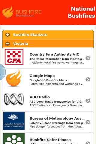
Latest information from:
- Country Fire Authority (CFA) Vic, cfa.vic.gov.au;
- Rural Fire Service (RFS) NSW, rfs.nsw.gov.au;
- Country Fire Service (CFS) SA, cfs.sa.gov.au;
- Rural Fire Service (RFS) QLD, ruralfire.qld.gov.au;
- Department of Fire and Emergency Services (DFES) WA, dfes.wa.gov.au;
- Tasmania Fire Service (TFS), fire.tas.gov.au;
- Rural Fire Service (RFS) ACT, esa.act.gov.au/actrfs;
- Police, Fire and Emergency Services (PFES) NT, pfes.nt.gov.au;
- Radio;
- Bureau of Meteorology Australia, bom.gov.au;
- Geoscience Australia, ga.gov.au;
- National and local media.
Critical information such as emergency radio broadcast frequencies and bushfire safer places is stored on your phone for quick access without mobile internet connection.
New features and performance improvements being added regularly. If you have any feature suggestions, please drop us an email at bushfireblankets.com